Loading... Please wait...
 Categories
Categories
- World Maps
- Books
- Calendars
- Topographical Maps
- Alabama
- Arkansas
- California
- Canada
- Colorado
- Delaware
- Arizona
- Connecticut
- CT - NY
- DE - NJ - PA
- Florida
- GA - FL
- Georgia
- Hawaii
- Idaho
- Illinois
- Indiana
- Iowa
- Kansas
- Kentucky
- Louisiana
- Maine
- Maryland
- Massachusetts
- MD - VA
- Michigan
- Minnesota
- Mississippi
- Missouri
- Montana
- NC - SC
- Nebraska
- Nevada
- New Hampshire
- New Jersey
- New Mexico
- New York
- NH - MA - RI
- North Carolina
- North Dakota
- Ohio
- Oklahoma
- Oregon
- Pennsylvania
- Rhode Island
- South Carolina
- South Dakota
- Tennessee
- Texas
- Utah
- Vermont
- Virginia
- Washington DC & Maryland Custom Topographic Maps
- Washington State
- West Virginia
- Wisconsin
- Wyoming
- Nautical Charts
- Atlantic Coast
- 400,000 Scale Charts
- 80,000 Scale Charts
- Alabama - Louisiana
- Albemarle & Pamlico Sounds
- Cape Hatteras to Amelia Island
- Chesapeake Bay
- Chesapeake Bay 80,000 Scale Custom Nautical Charts
- Custom
- Delaware, Maryland, Virginia
- Florida
- Florida 80,000 Scale Custom Nautical Charts
- New Engand
- NC-GA 80,000 Scale Custom Nautical Charts
- New England
- New England 80,000 Scale Custom Nautical Charts
- New Jersey
- New York
- New York 80,000 Scale Custom Nautical Charts
- Rhode Island 80,000 Scale Custom Nautical Charts
- Texas
- Texas 80,000 Scale Custom Nautical Charts
- General Charts
- Big Area Charts
- Harbor Charts
- Great Lakes
- All 5 Lakes
- Great Lakes Harbors
- Lake Erie Harbor Charts
- Detroit and St Clair Rivers Harbor Charts
- Lake Huron Harbor Charts
- Lake Michigan Harbor Charts
- Lake Ontario Harbor Charts
- Lake Superior Harbor Charts
- Minnesota-Ontario Border Lakes
- Northwest Lake Huron Harbor Charts
- St. Lawrence River Harbor Charts
- St. Lawrence River - Small Harbor Charts
- Great Lakes Survey - First Series
- Individual Lakes
- New York Canals & Lakes
- Other
- Inland Lakes
- Lake Champlain
- Pacific Coast
- Shipwreck Maps
- Panama Canal
- Atlantic Coast
- Fire Insurance Maps
- Geological Maps
- Alabama
- Alaska
- Arizona
- New England Maps
- Arkansas
- California
- Central America - Caribbean
- Colorado
- Connecticut
- Bird's Eyes
- City Maps
- County Map CDs - CT
- County Maps
- State Maps
- Towns
- Fairfield Co. CT - 1856 Town
- New Haven Co. CT - 1856 Town
- Fairfield Co. CT - 1858 Town
- Hartford Co. CT - 1855 Town
- Hartford & Vicinity CT - 1884 Town
- Hartford Co. CT - 1869 Town
- Litchfield Co. CT - 1859 Town
- Middlesex Co. CT - 1859 Town
- Middlesex Co. CT - 1874 Town
- New Haven Co. CT - 1852 Town
- New Haven Co. CT - 1868 Town
- New London Co. CT - 1854 Town
- Tolland Co. CT - 1857 Town
- Tolland Co. CT - 1869 Town
- Windham Co. CT - 1856 Town
- Delaware
- Florida
- Georgia
- Hawaii
- Idaho
- Illinois
- 1876 Warner & Beers State Atlas
- Bird's Eyes
- Cities
- County Wall Maps - IL
- State Maps
- Towns
- Adams Co. IL - 1889 Town
- Carroll Co. IL - 1869 Town
- Christian Co. IL - 1872 Town
- Christian Co. IL - 1893 Town
- Cook & Dupage Cos. IL - 1890 Town
- Cook Co. IL - 1861 Town
- Cook Co. IL - 1886 Town
- Cook, Dupage, & Will Cos, IL - 1898 Town
- DeKalb Co. IL - 1860 Town
- Edgar Co. IL - 1870 Town
- Edwards Co. IL - 1891 Town
- Franklin Co. IL - 1900 Town
- Greene Co. IL - 1861 Town
- Hancock Co. IL - 1859 Town
- Iroquois & Kankakee Cos. IL - 1860 Town
- Jefferson Co. IL - 1900 Town
- Kane Co. IL - 1860 Town
- Knox Co. IL - 1861 Town
- Lake Co. IL - 1861 Town
- Lake Co. IL - 1873 Town
- LaSalle Co. IL - 1895 Town
- Logan Co. IL - 1893 Town
- Madison Co. IL - 1892 Town
- McHenry Co. IL - 1862 Town
- Peoria Co. IL - 1861 Town
- Pike Co. IL - 1860 Town
- St. Clair Co. IL - 1863 Town
- St. Clair Co. IL - 1899 Town
- Stephenson Co. IL - 1859 Town
- White Co. IL - 1871 Town
- Whiteside Co. IL - 1896 Town
- Will Co. IL - 1862 Town
- Winnebago Co. IL - 1859 Town
- Indiana
- Bird's Eyes
- City Maps
- State Maps
- County Wall Maps - IN
- Indiana Lakes Maps
- Towns
- Boone Co. IN - 1865 Town
- Carroll Co. IN - 1897 Town
- Carroll Co. IN - 1898 Town
- Clark Co. IN - 1875 Town
- Clinton Co. IN - 1865 Town
- Dearborn Co. IN - 1860 Town
- Decatur Co. IN - 1867 Town
- DeKalb Co. IN - 1863 Town
- Floyd Co. IN - 1859 Town
- Floyd Co. IN - 1882 Town
- Fountain Co. IN - 1865 Town
- Grant Co. IN - 1861 Town
- Hamilton Co. IN - 1866 Town
- Hendricks Co. IN - 1865 Town
- Henry Co. IN - 1857 Town
- Huntington Co. IN - 1866 Town
- Jefferson Co. IN - 1900 Town
- Johnson Co. IN - 1866 Town
- Kosciusko Co. IN - 1866 Town
- Laporte Co. IN - 1862 Town
- Marion Co. IN - 1855 Town
- Marion Co. IN - 1866 Town
- Montgomery Co. IN - 1864 Town
- Morgan Co. IN - 1875 Town
- Noble Co. IN - 1860 Town
- Perry Co. IN - 1894 Town
- Putnam Co. IN - 1864 Town
- Randolph Co. IN - 1865 Town
- Rush Co. IN - 1856 Town
- Rush Co. IN - 1867 Town
- Shelby Co. IN - 1866 Town
- Starke Co. IN - 1898 Town
- St. Joseph Co. IN - 1863 Town
- Tippecanoe Co. IN - 1866 Town
- Vermillion Co. IN - 1872 Town
- Vigo Co. IN - 1858 Town
- Wabash Co. IN - 1861 Town
- Warren Co. IN - 1865 Town
- Whitley Co. IN - 1873 Town
- Iowa
- Bird's Eyes
- City Maps
- County Wall Maps - IA
- State Atlas
- State Maps
- Towns
- Adams Co. IA - 1884 Town
- Allamakee Co. IA - 1872 Town
- Black Hawk Co. IA - 1887 Town
- Buchanan Co. IA - 1900 Town
- Buena Vista Co. IA - 1884 Town
- Butler Co. IA - 1897 Town
- Calhoun Co. IA - 1884 Town
- Carroll Co. IA - 1884 Town
- Cedar Co. IA - 1863 Town
- Cherokee Co. IA - 1884 Town
- Clay Co. IA - 1896 Town
- Clinton Co. IA - 1865 Town
- Crawford Co. IA - 1883 Town
- Dallas Co. IA - 1883 Town
- Delaware Co. IA - 1869 Town
- Dickinson Co. IA - 1883 Town
- Dubuque Co. IA - 1900 Town
- Hamilton Co. IA - 1883 Town
- Jackson Co. IA - 1867 Town
- Jasper Co. IA - 1871 Town
- Jefferson Co. IA - 1871 Town
- Keokuk Co. IA - 1861 Town
- Linn Co. IA - 1881 Town
- Mahaska Co. IA - 1871 Town
- Marshall Co. IA - 1896 Town
- Monona Co. IA - 1884 Town
- O'Brien Co. IA - 1884 Town
- Plymouth Co. IA - 1884 Town
- Polk Co. IA - 1885 Town
- Sioux Co. IA - 1884 Town
- Story Co. IA - 1883 Town
- Wapello Co. IA - 1870 Town
- Warren Co. IA - 1859 Town
- Woodbury Co. IA - 1884 Town
- Wright Co. IA - 1885 Town
- Kansas
- Kentucky
- Bird's Eyes
- State Maps
- Cities
- County Wall Maps - KY
- Towns
- Barren Co. KY - 1877 Town
- Bourbon Co. KY - 1861 Town
- Boyle Co. KY - 1876 Town
- Christian Co. KY - 1878 Town
- Clark Co. KY - 1861 Town
- Fayette Co. KY - 1861 Town
- Garrard Co. KY - 1879 Town
- Harrison Co. KY - 1877 Town
- Jessamine Co. KY - 1861 Town
- Lincoln Co. KY - 1879 Town
- Madison Co. KY - 1876 Town
- Marion Co. KY - 1877 Town
- Mercer Co. KY - 1876 Town
- Montgomery Co. KY - 1879 Town
- Scott Co. KY - 1879 Town
- Washington Co. KY - 1877 Town
- Warren Co. KY - 1877 Town
- Woodford Co. KY - 1861 Town
- Louisiana
- Maine
- 1837 Coast Charts
- Acadia National Park Prints
- Bird's Eyes
- City Maps
- Coastline
- County Maps - Other
- County Wall Maps - ME
- Maine Lakes
- Map CDs - ME
- Mt. Desert Island & Bar Harbor Prints
- Regional
- State Atlases
- State Maps
- Towns
- Androscoggin Co. ME - 1858 Town
- Androscoggin Co. ME - 1873 Town
- Aroostook Co. ME - 1877 Town
- Cumberland Co. ME - 1857 Town
- Cumberland Co. ME - 1871 Town
- Franklin Co. ME - 1861 Town
- Hancock Co. ME - 1860 Town
- Kennebec Co. ME - 1856 Town
- Lincoln Co. ME - 1857 Town
- Oxford Co. ME - 1858 Town
- Penobscot Co. ME - 1859 Town
- Piscataquis Co. ME - 1858 Town
- Sagadahoc Co. ME - 1858 Town
- Somerset Co. ME - 1860 Town
- Waldo Co. ME - 1859 Town
- Washington Co. ME - 1861 Town
- York Co. ME - 1856 Town
- Maryland
- Bird's Eyes
- Chesapeake Bay Maps
- City Maps
- County Map CDs - MD
- County Maps - Other
- County Wall Maps - MD
- State Atlases
- State Maps
- Towns
- Anne Arundel Co. & Vicinity - 1878 Towns
- Anne Arundel Co. MD - 1860 Town
- Baltimore Co. MD - 1857 Town
- Carroll Co. MD - 1862 Town
- Cecil Co. MD - 1858 Town
- Frederick Co. MD - 1858 Town
- Harford Co. MD - 1878 Town
- Howard Co. MD - 1860 Town
- Kent Co. MD - 1860 Town
- Montgomery Co. MD - 1865 Town
- Montgomery Co., DC & Vicinity - 1879 Towns
- Wicomico, Somerset, Worcester Cos. MD - 1877 Town
- Massachusetts
- Aerial Photos
- Bird's Eyes
- Boston Early Maps
- Boston Maps
- Cape Cod
- City Maps - Not Boston
- County Map CDs - MA
- County Maps - 1844 Borden
- County Maps - 1861 Walling
- County Maps - MA
- County Maps - Other
- Harbor & Land Commission Boundary Atlases
- State Atlases
- State Highway Maps
- State Maps
- Towns
- Massachusetts Archive 1794 Town Prints
- Massachusetts Archive 1830s Town Prints
- Town Posters
- Barnstable Co. MA - 1858 Town
- Barnstable Co. MA - 1910 Town
- Berkshire Co. MA - 1858 Town
- Berkshire Co. MA - 1876 Town
- Berkshire Co. MA - 1904 Town
- Boston MA & Vicinity - 1852 Town
- Bristol Co. MA - 1858 Town
- Bristol Co. MA - 1895 Town
- Brookline 1874
- Brookline 1927
- Cambridge 1873
- Cambridge 1886
- Cambridge 1930
- Deerfield MA - 1855 Town
- Essex Co. MA - 1856 Town
- Essex Co. MA - 1872 Town
- Essex Co. MA - 1919 Town - Beverly & Manchester
- Franklin Co. MA - 1832 Town
- Franklin Co. MA - 1858 Town
- Franklin Co. MA - 1871 Town
- Hampden Co. MA - 1857 Town
- Hampden Co. MA - 1870 Town
- Hampden Co. MA - 1894 Town
- Hampden Co. MA - 1912 Town
- Hampshire Co. MA - 1856 Town
- Hampshire Co. MA - 1873 Town
- Hampshire Co. MA - 1860 Town
- Middlesex Co. MA - 1856 Town
- Middlesex Co. MA - 1875 Town
- Middlesex Co. Vol. 1 - Cambridge Area - 1900
- Middlesex Co. Vol. 2 - Concord to Wakefield 1906
- Norfolk Co. MA - 1858 Town
- Norfolk Co. MA - 1876 Town
- Plymouth Co. MA - 1857 Town
- Plymouth Co. MA - 1879 Town
- Plymouth Co. MA - 1903 Town
- Worcester Co. MA - 1857 Town
- Worcester Co. MA - 1870 Town
- Towns - Part Of
- Michigan
- Bird's Eyes
- State Maps
- Cities
- County Wall Maps - MI
- Towns
- Barry Co. MI - 1860 Town
- Gratiot Co. MI - 1864 Town
- Berrien Co. MI - 1860 Town
- Branch Co. MI - 1858 Town
- Calhoun Co. MI - 1858 Town
- Cass Co. MI - 1860 Town
- Cass Co. MI - 1897 Town
- Clinton Co. MI - 1864 Town
- Eaton Co. MI - 1860 Town
- Genesee Co. MI - 1859 Town
- Gartiot Co. MI - 1864 Town
- Gratiot Co. MI - 1876 Town
- Hillsdale Co. MI - 1857 Town
- Huron Co. MI - 1875 Town
- Ingham Co. MI - 1859 Town
- Ionia Co. MI - 1861 Town
- Jackson Co. MI - 1858 Town
- Kalamazoo Co. MI - 1861 Town
- Kalkaska Co. MI - 1898 Town
- Lake Co. MI - 1900 Town
- Lapeer Co. MI - 1863 Town
- Lenawee Co. MI - 1857 Town
- Livingston Co. MI - 1859 Town
- Macomb Co. MI - 1859 Town
- Monroe Co. MI - 1859 Town
- Montcalm Co. MI - 1875 Town
- Oceana Co. MI - 1876 Town
- Saginaw Co. MI - 1890 Town
- Sanilac Co. MI - 1876 Town
- Shiawassee Co. MI - 1859 Town
- St. Clair Co. MI - 1859 Town
- St. Joseph Co. MI - 1858 Town
- Van Buren Co. MI - 1860 Town
- Washtenaw Co. MI - 1856 Town
- Wayne Co. MI - 1860 Town
- Minnesota
- Bird's Eyes
- Cities
- County Wall Maps - MN
- Lake Minnetonka Maps
- State Maps
- Towns
- Blue Earth Co. MN - 1879 Town
- Brown Co. MN - 1886 Town
- Brown Co. MN - 1900 Town
- Carver Co. MN - 1880 Town
- Cottonwood Co. MN - 1898 Town
- Dakota Co. MN - 1874 Town
- Freeborn Co. MN - 1878 Town
- Hennepin Co. MN - 1879 Town
- Houston Co. MN - 1871Town
- Isanti Co. MN - 1898 Town
- LeSuer Co. MN - 1880 Town
- Lyon Co. MN - 1884 Town
- Martin Co. MN - 1901 Town
- Martin Co. MN- 1887 Town
- McLeod Co. MN - 1880 Town
- Murray Co. MN - 1898 Town
- Nicollet Co. MN - 1885 Town
- Pope Co. MN - 1901 Town
- Ramsey & Washington Counties - 1887 Town
- Ramsey Co. MN - 1885 Town
- Redwood Co. MN - 1898 Town
- Scott Co. MN - 1880 Town
- Sibley Co. MN - 1893 Town
- Steele Co. MN - 1879 Town
- Todd Co. MN - 1890 Town
- Watonwan Co. MN - 1898 Town
- Wright Co. MN - 1901 Town
- Mississippi
- Missouri
- Bird's Eyes
- Cities
- County Wall Maps - MO
- State Maps
- Towns
- Cass Co. MO - 1877 Town
- Cedar Co. MO - 1879 Town
- Cedar Co. MO - 1897 Town
- Clay Co. MO - 1887 Town
- Gasconade Co. MO - 1875 Town
- Grundy Co. MO - 1890 Town
- Henry Co. MO - 1877 Town
- Hickory Co. MO - 1880 Town
- Jackson Co. MO - 1887 Town
- McDonald Co. MO - 1884 Town
- Morgan Co. MO - 1880 Town
- Nodaway Co. MO - 1900 Town
- Pettis Co. MO - 1876 Town
- Saline Co. MO - 1871 Town
- St. Francois Co. MO - 1882 Town
- St. Louis Co. MO - 1880-1910 Town
- Vernon Co. MO - 1886 Town
- Montana
- Nebraska
- Nevada
- New Hampshire
- Aerial Photos
- Bird's Eyes
- City Maps
- County Maps - 1784 Holland
- County Maps - 1816 Carrigain
- County Wall Maps - NH
- Lakes
- Map CDs - NH
- State Atlases
- State Maps
- Towns
- Belknap Co. NH - 1860 Town
- Carroll Co. NH - 1861 Town
- Cheshire Co. NH - 1858 Town
- Cheshire Co. NH - 1877 Town
- Coos Co. NH - 1861 Town
- Grafton Co. NH - 1860 Town
- Hillsboro Co. NH - 1858 Town
- Merrimack Co. NH - 1858 Town
- Rockingham Co. NH - 1857 Town
- Strafford Co. NH - 1856 Town
- Strafford Co. NH - 1871 Town
- Sullivan Co. NH - 1860 Town
- White Mountains Maps
- New Jersey
- Bird's Eyes
- City Maps
- County Map CDs - NJ
- County Wall Maps - NJ
- State Maps
- Towns
- Atlantic Co. NJ - 1872 Town
- Monmouth Co. NJ - 1851 Town
- Ocean Co. NJ - 1872 Town
- Bergen & Passaic Co. NJ - 1861 Town
- Burlington Co. NJ - 1849 Town
- Burlington Co. NJ - 1859 Town
- Camden Co. NJ - 1857 Town
- Cape May Co. NJ - 1872 Town
- Cumberland Co. NJ - 1862 Town
- Essex Co. NJ - 1850 Town
- Essex Co. NJ - 1859 Town
- Essex Co. NJ - 1874 Town
- Gloucester Co. NJ - 1860 Town
- Hunterdon Co. NJ - 1851 Town
- Hunterdon Co. NJ - 1860 Town
- Mercer Co. NJ - 1849 Town
- Mercer Co. NJ - 1860 Town
- Mercer Co. NJ - 1875 Town
- Middlesex Co. NJ - 1850 Town
- Middlesex Co. NJ - 1861 Town
- Monmouth Co. NJ - 1861 Town
- Morris Co. NJ - 1853 Town
- NJ State Atlas - 1872 Town
- Salem & Gloucester Co. NJ - 1849 Town
- Somerset Co. NJ - 1850 Town
- Somerset Co. NJ - 1860 Town
- Sussex Co. NJ - 1860 Town
- Union Co. NJ - 1862 Town
- Warren Co. NJ - 1852 Town
- Warren Co. NJ - 1860 Town
- New Mexico
- New York
- Adirondack Maps
- Bird's Eyes
- Brooklyn Maps
- City Maps - Not NYC
- County Map CDs - NY
- County Maps - Other
- County Wall Maps - NY
- Long Island Maps
- New York City Maps
- New York Subway Maps
- NYC Area Maps
- NYC Small Areas
- Regionals
- Regionals - Canals
- Small County Maps
- Specials - Lakes
- State Atlases
- State Maps
- Staten Island Maps
- Towns
- Albany & Schenectady Cos. NY - 1866 Town
- Albany Co. NY - 1854 Town
- Allegany Co. NY - 1856 Town
- Broome Co. NY - 1855 Town
- Broome Co. NY - 1876 Town
- Cattaraugus Co. NY - 1856 Town
- Cayuga Co. NY - 1859 Town
- Cayuga Co. NY - 1875 Town
- Cayuga Co. NY - 1904 Town
- Chautauque Co. NY - 1854 Town
- Chautauqua Co. NY - 1867 Town
- Chemung Co. NY - 1853 Town
- Chemung Co. NY - 1869 Town
- Chenango Co. NY - 1855 Town
- Chenango Co. NY - 1863 Town
- Chenango Co. NY - 1875 Town
- Clinton Co. NY - 1856 Town
- Clinton Co. NY - 1869 Town
- Columbia Co. NY - 1851 Town
- Columbia Co. NY - 1873 Town
- Cortland Co. NY - 1855 Town
- Delaware Co. NY - 1856 Town
- Delaware Co. NY - 1869 Town
- Dutchess Co. NY - 1858 Town
- Erie Co. NY - 1855 Town
- Erie Co. NY - 1866 Town
- Erie Co. NY - 1880 Town
- Essex Co. NY - 1858 Town
- Essex Co. NY - 1876 Town
- Franklin Co. NY - 1858 Town
- Franklin Co. NY - 1876 Town
- Fulton Co. NY - 1856 Town
- Genesee Co. NY - 1854 Town
- Genesee Co., NY - 1876
- Greene Co. NY - 1856 Town
- Herkimer Co. NY - 1859 Town
- Hudson River Valley from NYC to Troy - 1891
- Jefferson Co. NY - 1855 Town
- Jefferson Co. NY - 1864 Town
- Kings & Queens Cos. NY - 1859 Town
- Kings & Queens Cos. NY - 1886 Town
- Lewis Co. NY - 1857 Town
- Lewis Co. NY - 1875 Town
- Livingston Co. NY - 1858 Town
- Long Island, NY - 1873 Towns
- Madison Co. NY - 1859 Town
- Madison Co. NY - 1875 Town
- Manhattan 1897 Atlas 1"=1800'
- Monroe Co. NY - 1852 Town
- Monroe Co. NY - 1858 Town
- Montgomery Co. NY - 1853 Town
- Montgomery & Fulton Cos. NY - 1868 Town
- New York City Port & Vicinity - 1857 Town
- Niagara Co. NY - 1852 Town
- Niagara Co. NY - 1860 Town
- Niagra & Orleans Cos., NY - 1875
- NYC & Environs - 1860 Town
- NYC & Vicinity - 1863 Town
- NYC & Vicinity - 1868 Town
- NYC Metro Area - 1891
- Oneida Co. NY - 1852 Town
- Onondaga Co. NY - 1852 Town
- Onondaga Co. NY - 1859 Town
- Ontario Co. NY - 1852 Town
- Ontario Co. NY - 1859 Town
- Orange Co. NY - 1859 Town
- Orange Co. NY - 1875 Town
- Orleans Co. NY - 1860 Town
- Oswego Co. NY - 1854 Town
- Oswego Co. NY - 1867 Town
- Otsego Co. NY - 1856 Town
- Otsego Co., NY - 1868
- Putnam Co. NY - 1854 Town
- Rensselaer Co. NY - 1861 Town
- Rockland Co. NY - 1859 Town
- Rural North of NYC - 1908 Town
- Saratoga Co. NY - 1856 Town
- Saratoga Co. NY - 1866 Town
- Schenectady Co. NY - 1856 Town
- Schoharie Co. NY - 1856 Town
- Schoharie Co. NY - 1866 Town
- Schuyler Co. NY - 1857 Town
- Schuyler Co., NY - 1874
- Seneca Co. NY - 1850 Town
- Seneca Co. NY - 1859 Town
- St. Lawrence Co. NY - 1858 Town
- St. Lawrence Co. NY - 1865 Town
- Steuben Co. NY - 1857 Town
- Steuben Co. NY - 1873 Town
- Suffolk Co. NY - 1858 Town
- Suffolk Co., NY - 1902 Atlas South Vol. 1
- Suffolk Co., NY - 1909 Atlas North Vol. 2
- Suffolk Co., NY - 1915-1917 Atlas Custom Prints
- Suffolk Co., NY - 1915 Atlas South Vol.1 - West
- Suffolk Co., NY - 1916 Atlas South Vol.2 - East
- Suffolk Co., NY - 1917 Atlas North Vol.1 - East
- Sullivan Co. NY - 1856 Town
- Sullivan Co. NY - 1875 Town
- Tioga Co. NY - 1855 Town
- Tompkins Co. NY - 1853 Town
- Tompkins Co. NY - 1866 Town
- Ulster Co. NY - 1853 Town
- Warren Co. NY - 1858 Town
- Warren Co. NY - 1876 Town
- Washington Co. NY - 1853 Town
- Wayne Co. NY - 1858 Town
- Wayne Co. NY - 1874 Town
- Westchester Co. NY - 1851 Town
- Westchester Co. NY - 1858 Town
- Westchester Co. NY - 1893 Town
- Wyoming Co. NY - 1853 Town
- Yates Co. NY - 1855 Town
- North Carolina
- North Dakota
- Ohio
- Bird's Eyes
- City Maps
- County Wall Maps - OH
- State Atlases
- State Maps
- Towns
- Allen Co. OH - 1880 Town
- Ashland Co. OH - 1861 Town - McDonnell
- Ashland Co. OH - 1861 Town - Nunan
- Ashland Co. OH - 1897 Town
- Ashtabula Co. OH - 1856 Town
- Athens Co. OH - 1875 Town
- Auglaize Co. OH - 1860 Town
- Brown Co. OH - 1876 Town
- Butler Co. OH - 1855 Town
- Champaign Co. OH - 1858 Town
- Champaign Co. OH - 1894 Town
- Clarke Co. OH - 1859 Town
- Clermont Co. OH - 1857 Town
- Clinton Co. OH - 1859 Town
- Columbiana Co. OH - 1841 Town
- Columbiana Co. OH - 1860 Town
- Coshocton Co. OH - 1850 Town
- Crawford Co. OH - 1850 Town
- Cuyahoga Co. OH - 1858 Town
- Darke Co. OH - 1857 Town
- Delaware Co. OH - 1849 Town
- Erie Co. (& part of Ottawa Co.) OH - 1863 Town
- Fairfield Co. OH - 1848 Town
- Fairfield Co. OH - 1889 Town
- Fayette Co. OH - 1875 Town
- Franklin Co. OH - 1856 Town
- Franklin Co. OH - 1883 Town
- Franklin Co. OH - 1895 Town
- Fulton Co. OH - 1850 Town
- Fulton Co. OH - 1888 Atlas
- Geauga Co. OH - 1857 Town
- Greene Co. OH - 1855 Town
- Guernsey Co. OH - 1855 Town
- Hamilton Co. OH - 1847 Town
- Hamilton Co. OH - 1856 Town
- Hamilton Co. OH - 1884 Town
- Hancock Co. OH - 1863 Town
- Hancock Co. OH - 1890 Town
- Hardin Co. OH - 1879 Town
- Harrison Co. OH - 1862 Town
- Highland Co. OH - 1871 Town
- Holmes Co. OH - 1861 Town
- Huron Co. OH - 1859 Town
- Jackson Co. OH - 1875 Town
- Jefferson Co. OH - 1856 Town
- Knox Co. OH - 1896 Town
- Lake Co. OH - 1857 Town
- Licking Co. OH - 1854 Town
- Logan Co. OH - 1890 Town
- Lorain Co. OH - 1857 Town
- Lucas Co. OH - 1861 Town
- Lucas Co. OH - 1888 Town
- Madison Co. OH - 1862 Town
- Mahoning Co. OH - 1860 Town
- Marion Co. OH - 1852 Town
- Medina Co. OH - 1857 Town
- Mercer Co. OH - 1888 Town
- Mercer Co. OH - 1900 Town
- Miami Co. OH - 1858 Town
- Monroe Co. OH - 1869 Town
- Montgomery Co. OH - 1851 Town
- Montgomery Co. OH - 1857 Town
- Montgomery Co. OH - 1869 Town
- Morgan Co. OH - 1854 Town
- Morrow Co. OH - 1857 Town
- Muskingum Co. OH - 1852 Town
- Paulding Co. OH - 1905 Town
- Perry Co. OH - 1859 Town
- Pickaway Co. OH - 1858 Town
- Portage Co. OH - 1857 Town
- Preble Co. OH - 1887 Town
- Preble Co. OH - 1897 Town
- Richland Co. OH - 1856 Town
- Ross Co. OH - 1860 Town
- Sandusky Co. OH - 1860 Town
- Sandusky Co. OH - 1891 Town
- Scioto Co. OH - 1875 Town
- Seneca Co. OH - 1864 Town
- Seneca Co. OH - 1891 Town
- Seneca Co. OH - 1896 Town
- Shelby Co. OH - 1865 Town
- Stark Co. OH - 1850 Town
- Stark Co. OH - 1855 Town
- Summit Co. OH - 1856 Town
- Trumbull Co. OH - 1856 Town
- Union Co. OH - 1877 Town
- Van Wert Co. OH - 1886 Town
- Vinton Co. OH - 1876 Town
- Warren Co. OH - 1856 Town
- Washington Co. OH - 1858 Town
- Wayne Co. OH - 1856 Town
- Wood Co. OH - 1886 Town
- Wyandot Co. OH - 1879 Town
- Oklahoma
- Oregon
- Pennsylvania
- Birdseyes
- Cities
- County Wall Maps - PA
- Pre-1840 PA County Maps
- State Maps
- Towns
- Adams Co. PA - 1858 Town
- Allegheny Co. PA - 1851 Town
- Allegheny Co. PA - 1862 Town
- Allegheny Co. PA - 1883 Town
- Allegheny Co. PA - 1898 Town
- Armstrong Co. PA - 1861 Town
- Beaver Co. PA - 1860 Town
- Bedford Co. PA - 1861 Town
- Berks Co. PA - 1854 Town
- Berks Co. PA - 1860 Town
- Blair Co. PA - 1859 Town
- Bradford Co. PA - 1858 Town
- Bucks Co. PA - 1850 Town
- Bucks Co. PA - 1860 Town
- Bucks Co. PA - 1891 Town
- Butler Co. PA - 1858 Town
- Cambria Co. PA - 1867 Town
- Cameron Co. PA - 1870 Town
- Carbon Co. PA - 1860 Town
- Centre Co. PA - 1861 Town
- Chester Co. PA - 1847 Town
- Chester Co. PA - 1856 Town
- Chester Co. PA - 1860 Town
- Clarion Co. PA - 1865 Town (BW)
- Clarion Co. PA - 1865 Town (Color)
- Clearfield Co. PA - 1866 Town
- Clinton Co. PA - 1862 Town
- Columbia Co. PA - 1860 Town
- Crawford Co. PA - 1865 Town
- Cumberland Co. PA - 1858 Town
- Dauphin Co. PA - 1858 Town
- Dauphin Co. PA - 1862 Town
- Delaware Co. PA - 1848 Town
- Delaware Co. PA - 1876 Town
- Elk Co. PA - 1855 Town
- Erie Co. PA - 1855 Town
- Fayette Co. PA - 1858 Town
- Fayette Co. PA - 1865 Town
- Forest Co. PA - 1858 Town
- Forest Co. PA - 1876 Town
- Forest Co. PA - 1881 Town
- Forest Co. PA - 1882 Town
- Forest Co. PA - 1895 Town
- Franklin Co. PA - 1858 Town
- Fulton Co. PA - 1873 Town
- Greene Co. PA - 1865 Town
- Greene Co. PA - 1897 Town
- Huntingdon Co. PA - 1856 Town
- Indiana Co. PA - 1856 Town
- Juniata Co. PA - 1863 Town
- Lackawanna Co. PA - 1879 Town
- Lancaster Co. PA - 1842 Town
- Lancaster Co. PA - 1851 Town
- Lancaster Co. PA - 1855 Town
- Lancaster Co. PA - 1858 Town
- Lawrence Co. PA - 1860 Town
- Lebanon Co. PA - 1860 Town
- Lehigh Co. PA - 1862 Town
- Lehigh Co. PA - 1865 Town
- Luzerne Co. PA - 1864 Town
- Lycoming Co. PA - 1861 Town
- McKean Co. PA - 1856 Town
- McKean Co. PA - 1857 Town
- McKean Co. PA - 1871 Town
- Mercer Co. PA - 1860 Town
- Mifflin Co. PA - 1863 Town
- Monroe Co. PA - 1860 Town
- Montgomery Co. PA - 1849 Town
- Montgomery Co. PA - 1860 Town
- Montgomery Co. PA - 1871 Town
- Montour Co. PA - 1860 Town
- Northampton Co. PA - 1851 Town
- Northampton Co. PA - 1860 Town
- Northumberland Co. PA - 1858 Town
- Northumberland Co. PA - 1874 Town
- Perry Co. PA - 1863 Town
- Pike Co. PA - 1856 Town
- Pike Co. PA - 1872 Town
- Potter Co. PA - 1856 Town
- Potter Co. PA - 1893 Town
- Schuylkill Co. PA - 1830 Town
- Schuylkill Co. PA - 1855 Town
- Schuylkill Co. PA - 1864 Town
- Somerset Co. PA - 1830 Town
- Somerset Co. PA - 1860 Town
- Sullivan Co. PA - 1872 Town
- Susquehanna Co. PA - 1858 Town
- Tioga Co. PA - 1862 Town
- Union Co. PA - 1856 Town
- Venango Co. PA - 1857 Town
- Venango Co. PA - 1865 Town
- Warren Co. PA - 1865 Town - Set 1 (Barnes)
- Warren Co. PA - 1865 Town - Set 2 (Beers)
- Warren Co. PA - 1865 Town - Set 3 (Hunt)
- Warren Co. PA - 1882 Town
- Warren Co. PA - 1889 Town
- Warren Co. PA - 1900 Town
- Washington Co. PA - 1856 Town
- Washington Co. PA - 1861 Town
- Wayne Co. PA - 1860 Town
- Westmoreland Co. PA - 1857 Town
- Wyoming Co. PA - 1869 Town
- York Co. PA - 1860 Town
- Puerto Rico
- Rhode Island
- South Carolina
- South Dakota
- Bird's Eyes
- County Wall Maps - SD
- State
- Towns
- Aurora Co. - 1900
- Bon Homme Co. - 1893
- Brookings Co. - 1897
- Clark Co. - 1900
- Codington Co. - 1898
- Deuel Co. - 1898
- Douglas Co. - 1900
- Grant Co. - 1899
- Hamlin Co. - 1897
- Hanson Co. - 1893
- Kingsbury Co. - 1899
- Lake Co. - 1899
- Lincoln Co. - 1893
- Lincoln Co. - 1900
- McCook Co. - 1900
- Miner Co. - 1898
- Minnehaha Co. - 1893
- Moody Co. - 1896
- Spink Co. - 1899
- Turner Co. - 1893
- Union Co. - 1892
- Union Co. - 1901
- Yankton Co. - 1894
- Tennessee
- Bird's Eyes
- City Maps
- County Wall Maps - TN
- State Maps
- Towns
- Bedford Co. TN - 1878 Town
- Rutherford Co. TN - 1878 Town
- Davidson Co. TN - 1871 Town
- Gibson Co. TN - 1877 Town
- Haywood Co. TN - 1877 Town
- Knox Co. TN - 1895 Town
- Madison Co. TN - 1877 Town
- Marshall Co. TN - 1899 Town
- Montgomery Co. TN - 1877 Town
- Maury Co. TN - 1878 Town
- Shelby Co. TN - 1888 Town
- Sumner Co. TN - 1878 Town
- Williamson Co. TN - 1878 Town
- Texas
- USA
- Utah
- Vermont
- Aerial Photos
- Bird's Eyes
- City Maps
- County Maps - 1821 Whitelaw
- County Maps - 1860 Walling
- County Maps - 1880s Gazetteers
- County Maps - Beers Atlases
- County Wall Maps - VT
- Lake Champlain
- Lotting Plans
- Map CDs - VT
- Specials
- State Maps
- State Maps - Beers Atlases
- Towns
- Addison Co. VT - 1857 Town
- Addison Co. VT - 1871 Town
- Bennington Co. VT - 1856 Town
- Bennington Co. VT - 1869 Town
- Caledonia Co. VT - 1858 Town
- Caledonia Co. VT - 1875 Town
- Chittenden Co. VT - 1857 Town
- Chittenden Co. VT - 1869 Town
- Chittenden Co. VT 1857 Posters
- Essex Co. VT - 1878 Town
- Franklin & Grand Isle Cos. VT - 1871 Town
- Franklin Co. VT - 1857 Town
- Lamoille Co. VT - 1878 Town
- Orange Co. VT - 1858 Town
- Orange Co. VT - 1877 Town
- Orleans Co. VT - 1878 Town
- Orleans, Lamoille & Essex Cos. VT - 1859 Town
- Rutland Co. VT - 1854 Town
- Rutland Co. VT - 1869 Town
- Washington Co. VT - 1858 Town
- Washington Co. VT - 1873 Town
- Washington Co. VT 1858 Posters
- Windham Co. VT - 1856 Town
- Windham Co. VT - 1869 Town
- Windsor Co. VT - 1856 Town
- Windsor Co. VT - 1869 Town
- Windsor Co. VT 1869 Posters
- Virginia
- Washington
- Washington DC
- West Virginia
- Wisconsin
- Bird's Eyes
- City Maps
- County Wall Maps - WI
- State Maps
- Towns
- Brown Co. WI - 1870 Town
- Dodge Co. WI - 1900 Town
- Eau Claire Co. WI - 1878 Town
- Fond du Lac Co. WI - 1858 Town
- Grant Co. WI - 1868 Town
- Jefferson Co. WI - 1900 Town
- Juneau Co. WI - 1876 Town
- Kenosha Co. WI - 1873 Town
- Kewaunee Co. WI - 1895 Town
- La Crosse Co. WI - 1890 Town
- Milwaukee Co. WI - 1858 Town
- Monroe Co. WI - 1877 Town
- Racine Co. WI - 1873 Town
- Rock Co. WI - 1900 Town
- Sauk Co. WI - 1850 Town
- Sheboygan Co. WI - 1862 Town
- Walworth Co. WI - 1857 Town
- Walworth Co. WI - 1900 Town
- Waukesha Co. WI - 1900 Town
- Winnebago Co. WI - 1862 Town
- Wyoming
- Views & Photos
- World
- Africa Maps
- Germany
- Eastern Europe
- Europe Atlases
- France
- Great Britain
- Ireland
- Scotland
- Novelty Maps
- Home
- Nautical Charts
- Atlantic Coast
- Harbor Charts
- Rhode Island
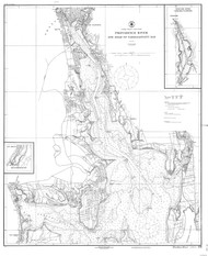
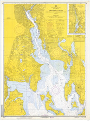
- Providence River 1937 - Old Map Nautical Chart AC Harbors 278 - Rhode Island


)

Product Description
Click to view a large version of this print
Year - 1937
Publisher - USCGS
Original Size - 33x41
Print Sizes-
Small - 18x22
Medium - 24x29
Large - 36x48
Scale -
Academic Title - Providence River and head of Narragansett Bay
Chart Number - 278
Year - 1937
Publisher - USCGS
Original Size - 33x41
Print Sizes-
Small - 18x22
Medium - 24x29
Large - 36x48
Scale -
Academic Title - Providence River and head of Narragansett Bay
Chart Number - 278